

- Height: 668m (2192 feet).
- Faces Pen-y-ghent across upper reaches of Silverdale.
- Fountains Fell Tarn is situated in a depression on the eastern side of the plateau.
- The Pennine Way passes near the summit.
- Its name comes from the fact it was once owned by the Cistercian Order of monks based at Fountains Abbey near Ripon.
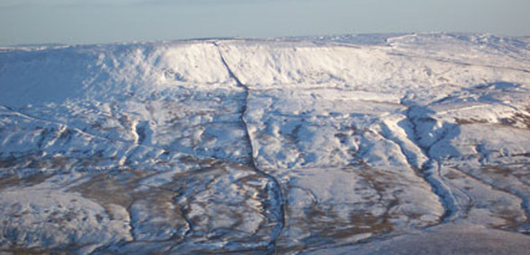
Fountains Fell's tiered terraces of limestone rise up from Pen-y-ghent Gill and, while it doesn't have a distinctive look or the features that you can see on Pen-y-ghent, it does provide great views of the Three Peaks in all their glory.
There are several routes to the top – from the Pennine Way, Silverdale or Tennant Gill north of Malham Tarn – and it can become part of an extended walk taking in the nearby summits of Knowe Fell and Darnbrook Fell.
The summit is littered with tall cairns and the shafts of disused coal mines and you can still see a well-made track going up the shoulder of Fountains Fell that was built to bring coal from the summits down to the valley. Find out more about the coal industry in the Dales on our Out of Oblivion website.
Many of the shafts date from 1790 to 1860 and were dug as shallow shafts – vertical shafts that open out like a bell at the bottom and need no props or air vents. When the pit became too large, a new one was started nearby.
There is also an unusual beehive coke oven measuring about 4 metres square and 2 metres high in the coalmining field founded around 1807 by Lord Ribblesdale. It was built to provide fuel for the Malham calamine industry but, after 1815, the coke was also used for smelting lead on Malham Moor. Read more about it on our Out of Oblivion website.


