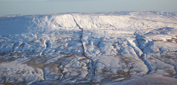

Fountains Fell is a fine summit on the Pennine Way which lies between Malham Tarn and one of the Three Peaks - Pen-y-Ghent.
- Summit is at 668m (2192 feet)
- Coal was once mined on the summit area
- Fountains Fell gets its name because it was once owned by Fountains Abbey
- The Pennine Way runs over the hill
Fountains Fell is usually approached using the Pennine Way, either starting from Malham Tarn or from Dale Head on the road between Stainforth and Halton Gill. The Pennine Way does not actually go to the summit and you need to branch off next to a tall cairn. Here you will see a number of fenced shafts which were from coal was mined here between 1790 and 1860. You need to be careful if you wander off the paths in this area because some of the old shafts might not be fenced.
There is an alternative descent to Malham Tarn taking the ridge down past Fountains Fell Tarn. All this area was once owned by the monks at Fountains Abbey over 25 miles (40km) away near Ripon, who used the area for sheep grazing.


